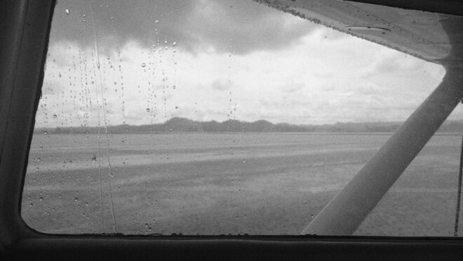
Why Rote Memorization Fails on the Flight Line
Flashcards are useful for learning that a METAR is an observation, a TAF is a forecast, and that codes such as OVC, 9999, or G25KT have specific meanings. That knowledge may help on a written examination, but it does not by itself answer the operational questions waiting on the ramp. Is the weather improving or deteriorating? Will the runway remain usable when the flight returns? Is a seemingly acceptable ceiling paired with a crosswind, gust spread, or temperature trend that deserves closer attention?
A flight instructor reads weather as a developing atmospheric story. The METAR provides the latest chapter, while the TAF describes the likely plot over the planned period. Neither should be treated as an isolated line of gibberish. Read the groups in sequence, connect them with the forecast trend, compare them with personal minimums, and then ask what the conditions will mean for takeoff, en route workload, approach stability, and the escape options available if the forecast is wrong.
Anatomy of a METAR Walkthrough Beyond Basic Definitions
A METAR is most useful when decoded in order, because each group adds another part of the airport environment. Consider a report such as KABC 041755Z 22012G20KT 5SM -RA BKN012 OVC025 18/17 A2992 RMK PK WND 21028/1720. The station identifier comes first, followed by the observation time in UTC. Wind then establishes the basic aerodynamic picture: direction, sustained speed, and, when present, gusts. Visibility and present weather indicate whether precipitation, haze, mist, or other obscurations are affecting visual references.
Cloud groups must be interpreted operationally rather than merely translated. A broken layer is not automatically a ceiling, but the lowest broken or overcast layer is significant for ceiling considerations. Temperature and dew point provide both atmospheric context and a warning about possible visibility changes. The altimeter setting completes the standard portion of the report. Finally, the remarks section may add peak wind information, precipitation timing, pressure trends, or other details that help explain where the weather is heading.
- Confirm the time. Make sure the observation date and UTC time are current enough for the decision. A report that was acceptable an hour ago may no longer describe the runway environment.
- Establish the wind picture. Compare direction and speed with runway orientation, aircraft limitations, and personal crosswind and gust limits. A 12-knot wind with 20-knot gusts deserves more attention than the sustained value alone suggests.
- Assess visibility, weather, and ceiling together. Rain, mist, low cloud, and a narrowing visibility trend can increase workload even when each individual value remains technically manageable.
- Read temperature and dew point as a trend signal. A small spread means the air is close to saturation. If cooling continues, fog or low stratus may develop quickly, particularly overnight or near wet ground.
- Finish with the remarks. Look for peak wind, precipitation beginning or ending, runway condition information, and pressure tendencies that may explain a changing observation.
Regulatory benchmarks still matter, but they are not substitutes for judgment. Official guidance helps pilots use consistent definitions and understand how aviation weather products are constructed. The FAA maintains its collection of Advisory Circulars, which is a useful starting point when reviewing reporting standards and operational guidance. Always distinguish between a regulatory requirement, a forecast product, and a personal minimum. A condition can be legal and still be unsuitable for a particular pilot, aircraft, or mission.
The temperature and dew point deserve special emphasis because they can reveal a problem before the visibility has fully deteriorated. A spread of only a degree or two does not guarantee fog, but it indicates very little moisture margin. Add calm or light winds, clear skies, recent rain, or a low-lying airport, and the probability of rapid surface fog formation increases. The remarks may then provide the missing context. A peak wind group can show that the airport has already experienced stronger gusts than the headline wind suggests, while precipitation timing can confirm whether a shower is arriving or departing. Do not stop decoding when the standard groups end.
Decoding TAF Evolution Without Getting Trapped by Timing Codes
A TAF is not a promise that one set of conditions will exist continuously. It is a forecast of expected conditions and changes during a stated validity period. The most important skill is identifying when a change begins, how long it is expected to last, and how much confidence the forecaster has in it. First read the validity period, then establish the prevailing conditions, and only afterward interpret the change groups.
FM means “from” and marks a relatively decisive change beginning at the specified time. Once the FM time arrives, the new wind, visibility, weather, and cloud groups describe the prevailing forecast. TEMPO describes temporary fluctuations expected to occur during a window, generally lasting less than an hour at a time and not prevailing throughout that period. BECMG indicates a gradual transition over a stated interval. PROB30 indicates a 30 percent probability of specified conditions during a particular period. These distinctions should shape planning, but they do not eliminate the need to consider what happens if the less favorable condition occurs.
| TAF group | What it indicates | Practical planning question |
|---|---|---|
| FM | A significant change beginning at a precise UTC time | Will the departure or arrival occur before or after the new conditions take over? |
| TEMPO | Temporary fluctuations within a stated period | Can the flight tolerate a short-lived reduction in visibility, ceiling, or wind quality? |
| BECMG | A gradual transition during a time window | When is the transition most likely to affect the operation? |
| PROB30 | A 30 percent chance of specified conditions | What is the plan if the unfavorable possibility becomes reality? |
Students commonly treat a PROB30 group as either irrelevant or certain. Both reactions are poor risk management. A 30 percent possibility of thunderstorms, low visibility, or a significant ceiling reduction is not a forecast to ignore, especially when the flight has limited fuel, few alternates, or a demanding arrival. Alternate planning also depends on the applicable regulations, aircraft equipment, operation, and current official guidance. Do not assume that a probability group automatically satisfies or defeats a particular alternate requirement without checking the rules governing the flight.
Timing errors are another frequent source of trouble. TAF times are UTC, and a group such as FM100000 means the change begins at 0000Z on the 10th, not at local midnight unless the local conversion happens to match. Place every group on a timeline. Then compare that timeline with estimated departure, arrival, turnaround, and return times. A forecast that looks comfortable at departure may place the aircraft at its destination during a TEMPO period or just as an FM group introduces lower ceilings and stronger winds.
Spotting Low Level Wind Shear and Non-Convective Hazards
Low-level wind shear is a rapid change in wind speed and or direction close to the ground. National Weather Service guidance defines it as a change of at least 10 knots per 100 feet within a layer more than 200 feet thick and located within 2,000 feet of the surface. Small general aviation aircraft are particularly vulnerable because approach speeds are relatively close to stall speeds, leaving less energy margin when the wind changes abruptly. The National Weather Service LLWS safety guidance explains why these velocity changes can compromise an approach and why pilots should prepare before entering the pattern.
In a TAF, a group such as WS020/07040KT forecasts wind shear through 2,000 feet above ground level, with wind at the top of that layer from 070 degrees at 40 knots. If the surface wind is 010 degrees at 8 knots, the forecast implies both a major speed increase and a substantial directional change with altitude. The code does not describe exactly how the wind changes through the layer, and LLWS is not automatically a forecast of severe turbulence. It can occur in stable, smooth air when a temperature inversion separates light surface winds from stronger winds above.
- Inversions: Overnight cooling can produce light winds at the surface while stronger flow continues above the inversion.
- Frontal passages: Wind direction and speed may shift rapidly as a front moves through the airport area.
- Downbursts and outflow: Thunderstorms and heavy showers can generate outward-moving air that produces dangerous shear near the runway.
- Terrain and local effects: Mountain lee effects, sea-breeze fronts, and strong regional winds can create sharp changes that are not obvious from the surface observation.
- Approach consequences: A changing headwind, tailwind, or crosswind can alter airspeed, descent rate, crab angle, and runway alignment within seconds.
Use the TAF shear group as a prompt for deeper investigation, not as an automatic cancellation or acceptance decision. Compare it with current METARs, nearby airport observations, AIRMETs, hazardous weather messages, and recent pilot reports. A smooth ride en route does not guarantee a stable final approach. Conversely, a forecast of non-convective shear may be manageable with appropriate aircraft-specific procedures, a stabilized approach policy, and a clear go-around plan. If shear is reported near the landing site, consider whether another airport offers a safer option and whether sufficient fuel remains to reach it without pressure.
Before departure, brief the likely indications and the response. An unexpected airspeed increase or decrease close to the ground is not the moment to improvise. Follow the aircraft flight manual, operator procedures, and instructor-approved wind-shear technique. Avoid chasing every airspeed fluctuation with abrupt pitch or power changes, maintain the required attitude and energy strategy, and be prepared to discontinue the approach if the aircraft does not remain stabilized. Pilot reports are especially valuable because they provide real-world information about what the wind is doing at approach altitude, not merely what a model or forecast expected.
Building a Defensible Go or No-Go Assessment Checklist
A sound decision combines observation, forecast, aircraft capability, pilot readiness, and external pressure. The METAR tells you what is happening now. The TAF tells you what is expected to change. Your personal minimums define the conditions under which you can operate with adequate margin. Treat these as three separate inputs, then evaluate their relationship rather than searching for one magic number that answers the question.
- Check the pilot. Consider fatigue, recent experience, instrument currency, stress, and familiarity with the route or airport.
- Check the aircraft. Confirm equipment, fuel, performance, crosswind capability, deicing needs, and any unresolved discrepancy.
- Check the environment. Compare ceiling, visibility, wind, gusts, shear, precipitation, terrain, daylight, and forecast timing with established minimums.
- Check the alternatives. Identify usable airports, fuel reserves, escape routes, and the point at which the plan will be abandoned.
- Check the pressure. Remove schedule, passenger, financial, or ego-driven reasons for accepting conditions that do not meet the plan.
The most dangerous weather decisions often involve accumulation. A 10-knot crosswind may be acceptable, a 2,000-foot ceiling may be comfortable, and a two-degree temperature and dew point spread may seem harmless. Together with gusts, a night arrival, unfamiliar terrain, and a TEMPO group for lower visibility, they can produce a workload level far beyond what any single item suggests. A conservative decision is not an admission of inadequate skill. It is evidence that the pilot in command is protecting options before those options disappear.
Turn Encoded Data into Confident Cockpit Leadership
Reading METARs and TAFs well means moving from translation to anticipation. Decode the report, build the timeline, identify the trend, and connect each weather element to a specific aircraft task. Ask how the wind will affect runway selection, how the ceiling will affect approach choices, how falling visibility will affect visual references, and what action will be taken if the forecast is wrong. That sequence turns an abstract weather briefing into an operational plan.
Make the discussion routine before every flight, including familiar local flights on apparently calm days. Weather changes, forecasts have uncertainty, and a pilot who practices deliberate evaluation in easy conditions is better prepared when conditions become marginal. With consistent use of observations, forecasts, pilot reports, personal minimums, and clear diversion criteria, encoded data becomes more than information. It becomes a practical safety buffer that supports calm decisions and protects every landing.